![]() Ancient
Navigation Glyphs Found On
Arizona Strip
Ancient
Navigation Glyphs Found On
Arizona Strip
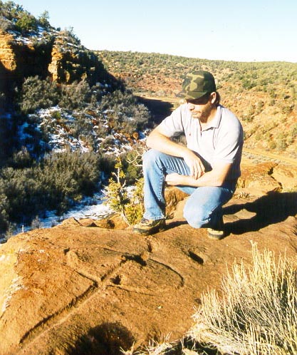
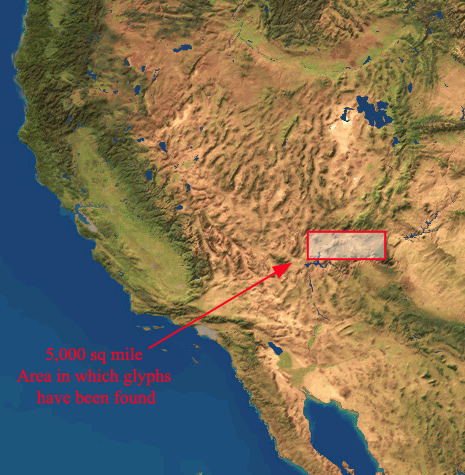
In May, 2001, a team of researchers completed a 5 year survey of a particular series of ancient rock carvings on the Arizona Strip. These glyphs cover an area of more than 2,000 square miles along the Utah, Arizona and Nevada borders.
This research team includes Bob Ford, who made the original discovery of these marks,and published his initial findings ( http://144.38.20.128/ cody/bobby.html ) , in June of 1997.
The team found 128 of these "Water Glyphs", surveying, cataloging, recording exact latitude / longitude using Trimble GPS units, collecting compass azimuth readings & photographing each glyph.
These portable Trimble GPS field units are accurate to 2 meters. Because of the remoteness of many of the glyphs, Surveyor grade GPS units ( capable of sub - centimeter accuracy ) were not used.
These geo-spatial data were then corrected for Atmospheric anomalies by Southern Utah University's GIS/GPS Lab, using the Dixie National Forest Service base station, located in Cedar City Utah. Using this data, maps of the known glyphs have been created and dispersed to members of the research team for further analysis.
As these maps reveal more information regarding the relationship of these glyphs to known water sources, mineral deposits, known ruins and each other, appropriate information will be made available to the public via this website.
We invite any casual visitors to browse the material at this website to learn more about the history and thought behind this startling discovery...
| TEAM MEMBERS | WORKS CITED
CONTACT US @ WATER GLYPHS