the Project:4
Dixon told me he had seen the mark up Johnson Canyon while on a high school field trip in the early 60's. He also spoke of one he had seen in a canyon below Fredonia. Interestingly, we relocated this mark just across the canyon from Dennis's mark. Checking around we soon discovered several more.
One in particular caught my attention; it pointed west through a natural notch in the hills. In the distance a large elm tree at an old abandoned homestead was visible through the notch. Directly beyond that tree was the knoll Bruce had told me about.
Burrows discovered another mark about a mile to the south of this canyon that pointed to the proximity of Dixon's marks. These and others we have examined lead us to believe they are directional.
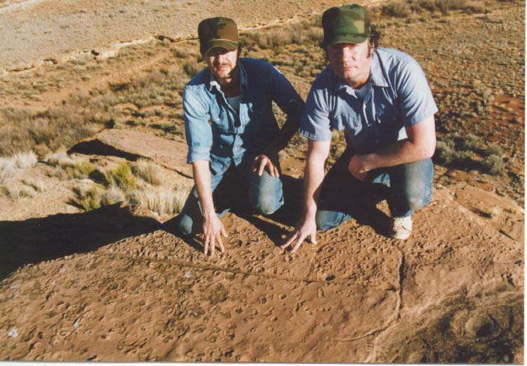
I was showing Ronald Mace photographs of some marks one afternoon and asked if he had ever seen any. He said he had seen one from horseback while riding his range up on the Sands and another was down on his farm. It took Rod and I three tries to locate the one on the sands. The one on the farm his granddaughter had found only a few years earlier. This mark had broken apart, a pie shaped rock with just the circle had fallen from the cliff leaving the line up top.
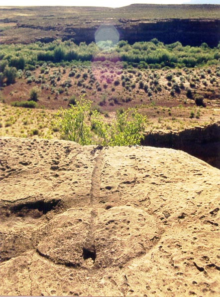
Robert, Rod, Dixon and I began
walking the canyon rims and ridges. We discovered the marks were
everywhere. After a while you could almost predict where you were
going to find one. We have located over 300 marks in Coconino, Mohave,
Kane and Washington counties..

| TEAM MEMBERS | WORKS CITED
CONTACT US @ WATER GLYPHS